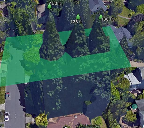
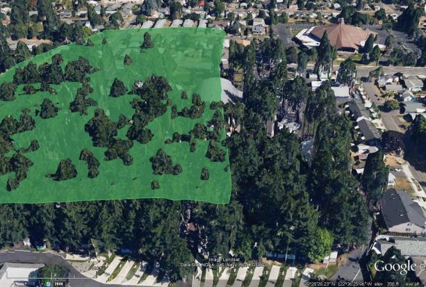
Turn on Google Earth’s 3D Buildings Icon. Create a polygon filter and adjust at desired altitude to filter height and find tallest tree. Google 3D renderings are photo realistic, and tend to be better than 95% accurate on flat land.
Accurately measuring trees on slopes and steep terrain is much more difficult. In this instance, subtracting crown height from base Google DEM terrain (non 3D mode) elevation will give a good proxy of height, yet DEM data itself can be inaccurate by as much as 50 – 100 feet. 3D Mode has finer and more exact elevation data. It is also worthy to consult other elevation databases to ensure accurate elevation at the base of the tree.
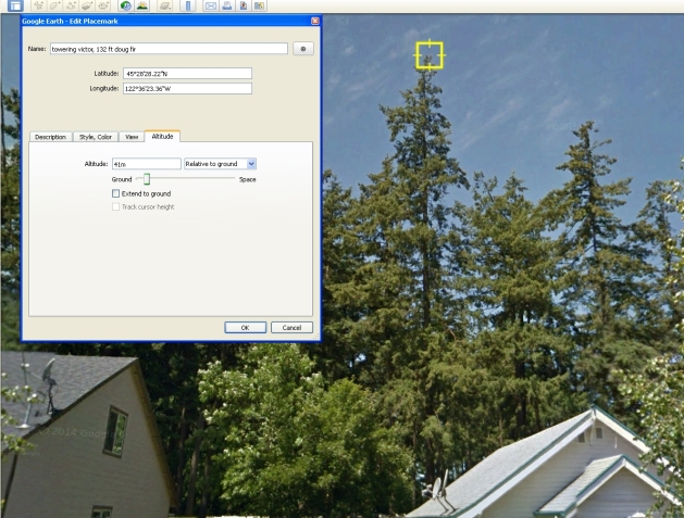
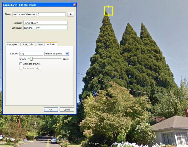
To Measure trees in Google Street view first select the desired location of the tree’s trunk, or directly under where the tree’s highest point is. Add a placemark at this location, then turn on the Google Street View mode. While in Street view mode, adjust the height of the placemark until it aligns with the top of the tree’s crown. This method is even more accurate than the 3D mode, as the 3D polygons some times do not render the top 5 or 10 feet or more in slender trees, steeples, etc:
My post at Google’s forum: https://productforums.google.com/forum/#!topic/gec-open-forum/rsf8Ul4NPGo


